Downloads
DOI:
https://doi.org/10.58981/bluepapers.2023.2.09Published
Issue
Section
License
Copyright (c) 2023 Theo Kremer, Marco Scheffers, Julia Geven

This work is licensed under a Creative Commons Attribution 4.0 International License.
How to Cite
Abstract
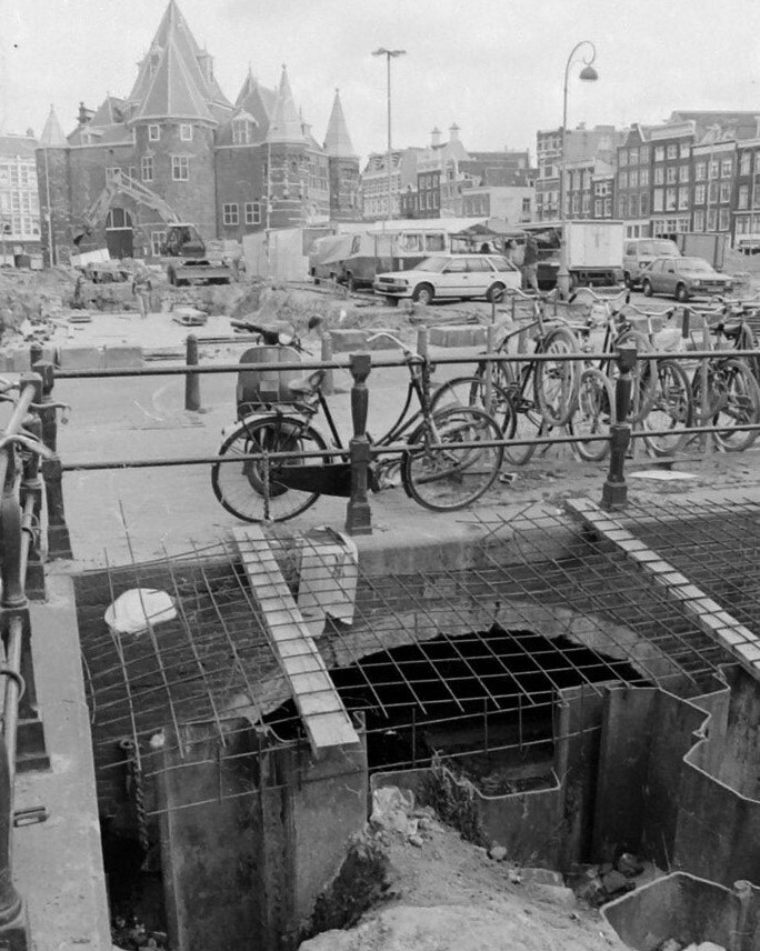
Historical information is an important resource for designing and sustainably developing contemporary cities, notably ones such as Amsterdam that have long histories. The historical information is embedded in physical places and structures as well as practices; it is also found in plans and texts that are held in multiple archives. It can be difficult to connect information about the past -- e.g., building materials, construction technologies, plans and proposals -- to contemporary needs and themes. Access to archives is not standardized, the material is not always digitized and it is not compatible with contemporary information systems, such as BIM and GIS. Information that has been organized in the past according to the criteria and values of the past does not always relate to current systems: think of historic handwritten documents, maps or drawings that are geolocalized, historical street names or terminologies. More attention is needed to effectively link historical data to sustainable development, while protecting the heritage of our historic cities. Doing this work is crucial: the information of today is the heritage of the future.
References
Riccetti, Alessandra, and Joyce van den Berg. 2020. Werkboek: Integrale Ontwerpmethode Openbare Ruimte [Handbook: Integral design method public space]. Amsterdam: Gemeente Amsterdam. https://openresearch.amsterdam/nl/page/59863/deel2---werkboek.
Water Knowledge Action Program. n.d. “Afwegen binnen het Integraal Gebiedsplan Wallengebied” [Considerations within the integrated area plan for the red-light district]. Accessed June 30, 2023. https://www.kennisactiewater.nl/case/afwegen-binnen-het-integraal-gebiedsplan-wallengebied/.
